

Guide to the towns of Guadeloupe
An overview of each town: population, local activities and top tips to help you plan your stay.
Guadeloupe comprises 32 municipalities, each with its own distinct character: fishing ports, beaches, mangroves and business parks. This guide introduces you to each town, its practical amenities and the experiences you can enjoy there with ICIGO.
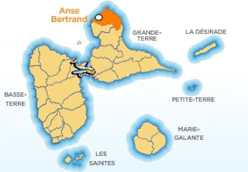
Anse-Bertrand
Peaceful and centred on fishing, Anse-Bertrand is nonetheless a popular tourist destination. Formerly a region known for cotton and sugar cane, Anse-Bertrand is situated at the northern tip of Grande-Terre. Although the land is particularly arid and rocky, Anse-Bertrand offers magnificent and breathtaking scenery! Cliffs, coves and superb beaches make up its landscape.
Read the full guide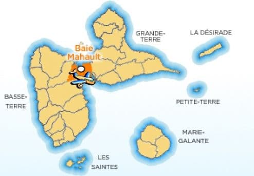
Baie Mahault
Once virtually uninhabitable due to its marshy terrain, the town of Baie Mahault is now the economic and industrial heart of Guadeloupe. Situated in the centre of the island, at the junction of the two islands, Basse-Terre and Grande-Terre, you can go shopping there or enjoy the three bays: Baie Mahault, Le Lamentin and Dupuy. There are also plenty of water sports on offer.
Read the full guide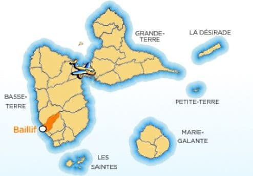
Baillif
To the south-west of Basse-Terre lies the peaceful and welcoming village of Baillif. It offers a tranquil and exotic setting, far from the hustle and bustle. That said, Baillif is by no means lacking in points of interest and attractions, both historical and tourist-oriented. Threatened by the English 200 years ago, a defence tower was erected there by the Dominican priest Jean-Baptiste Labat.
Read the full guide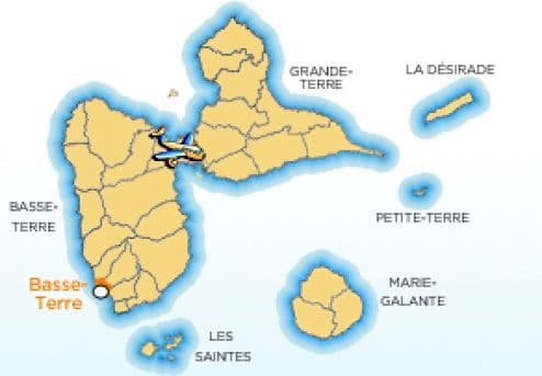
Basse-Terre
In the south-west of Guadeloupe, Basse-Terre is an ancient and imposing town. It is the administrative capital of the archipelago. Situated at the foot of the ‘La Soufrière’ volcano, it seems to be nestled within this rugged landscape, boasting a remarkable seafront promenade. Set in a beautiful mountainous region, a host of attractive activities await tourists.
Read the full guide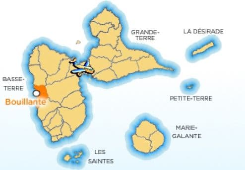
Bouillante
Bouillante – ‘the green one’, one might say, given how committed this commune on Basse-Terre is to environmentalism. Nestled between the Caribbean Sea and volcanic mountains, Bouillante offers plenty to attract tourists eager to connect with nature. Bouillante is world-renowned for its scuba diving. Numerous hiking trails pass through or are accessible from Bouillante and form part of the National Park.
Read the full guide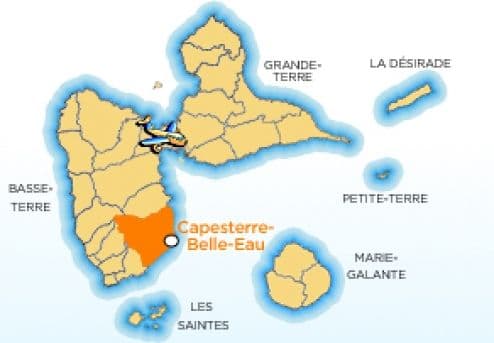
Capesterre-Belle-Eau
Steeped in history, Capesterre – formerly known as ‘La Vaillante’ – can take pride in its remarkable natural heritage. Discovered by Christopher Columbus on 4 November 1493 due to its waterfalls, which are visible from the sea, Capesterre-Belle-Eau, situated to the east of the island of Basse-Terre, is a worthy representative of Guadeloupe, ‘the island of beautiful waters’, a land of sugar cane and bananas.
Read the full guide
Capesterre-de-Marie-Galante
Located in the south-east of the island, Capesterre is a very pretty, quiet and peaceful little town nestled between Pointe la Feuillère and Pointe du Gros Cap. Protected by the coral reef, Capesterre boasts magnificent white sandy beaches, including the renowned Feuillère beach, fringed by coconut palms where visiting tourists love to linger.
Read the full guide
Deshaies
A popular stopover for cruise ships, the town of Deshaies boasts some of the most beautiful beaches in Guadeloupe. Offering an extraordinary view overlooking the sea, the town’s higher ground provides a magnificent vista of the sea and cliffs plunging into the water. Although Deshaies is a small fishing village, it is by no means lacking in tourist attractions.
Read the full guide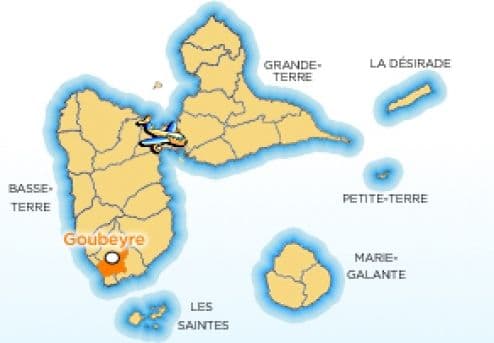
Gourbeyre
Gourbeyre is a spa town in the far south-west of Basse-Terre. It could just as easily be called ‘Gourbeyre-les-Eaux’ or ‘Gourbeyre-les-Bains’, given the abundance of springs, waterfalls, pools and rivers in the area. Furthermore, its Marina de Rivière Sens, with its 300 berths, offers a wide range of water sports.
Read the full guide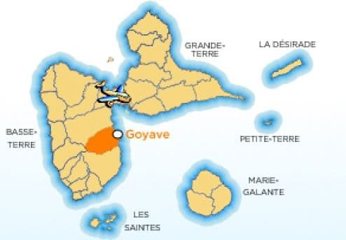
Goyave
To the east of the island of Basse-Terre, Goyave is a pretty little residential village, overlooking the bay of Petit Cul de Sac Marin and running alongside the Petite Rivière à Goyaves, from which it takes its name. With a focus on outdoor activities, Goyave has a pleasant beach where a range of activities can be enjoyed.
Read the full guide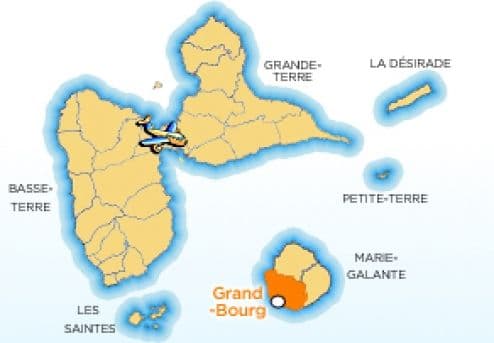
Grand-Bourg
Grand-Bourg de Marie-Galante is the island’s administrative capital. It certainly lives up to its name, being the island’s most impressive town in terms of both infrastructure and its bustling activities. Grand-Bourg pulsates to the rhythm of its shops, its delightful seaside bars, its restaurants and its market.
Read the full guide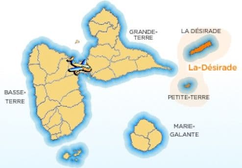
La Désirade
To the east of Pointe des Châteaux lies La Désirade, the oldest island in the Lesser Antilles – a land of culinary delights and an unspoilt paradise, the island everyone longs for! A high, tabular plateau rising out of the water, its unusual shape is reminiscent of the keel of an upturned boat. A place of unspoilt nature, La Désirade and its genuine, particularly kind and welcoming inhabitants are sure to charm you. A trip to La Désirade is a must to discover its wild landscapes and magnificent beaches.
Read the full guide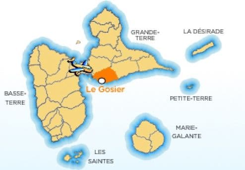
Le Gosier
Le Gosier, the region’s flagship town, is one of Guadeloupe’s top tourist destinations. Its picturesque village overlooks the ocean and the beautiful Gosier islet. Bordering the capital, Pointe-à-Pitre, Le Gosier offers tourists a wide range of water sports and cultural activities. A wide range of excursions to discover the local flora and fauna are organised from its bustling marina or the hotels’ water sports centres.
Read the full guide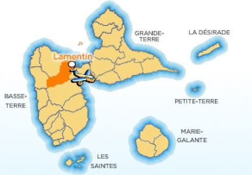
Le Lamentin
The commune of Le Lamentin in Guadeloupe is situated on the shores of the Grand Cul-de-Sac Marin in the centre of Grande-Terre. The village takes its name from the marine mammal due to its former presence at the mouths of the rivers flowing into the Grand Cul-de-Sac Marin. Far from mass tourism, Le Lamentin offers great potential for eco-tourism.
Read the full guide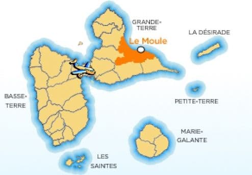
Le Moule
Le Moule, the former capital of Guadeloupe, is one of the oldest towns in the archipelago. Overlooking the Atlantic Ocean, its seafront promenade is exceptional. The ocean’s imposing, translucent waves delight even the most seasoned surfers and provide a marvellous spectacle that is not to be missed.
Read the full guide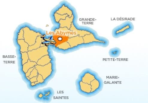
Les Abymes
Les Abymes is the most populous municipality in Guadeloupe. It is situated in northern Grande-Terre and, bordering Pointe-à-Pitre, forms part of the Pointe-à-Pitre conurbation. Although densely populated, it is nonetheless rich in tourist attractions, including its location overlooking the Grand-Cul-de-Sac bay.
Read the full guide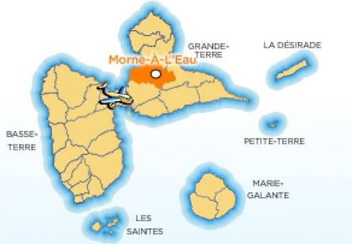
Morne-à-l'Eau
Morne-à-l'Eau is a small commune on Grande-Terre situated at a crossroads. It lies at the junction between the north and south of Grande-Terre and on the road to Basse-Terre. In the heart of rural Guadeloupe, it boasts an unusual cemetery – a real local curiosity – as well as some exceptional natural sites. Always buzzing with activity, in Morne-à-l'Eau you are right at the heart of the country.
Read the full guide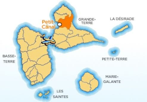
Petit Canal
Situated in northern Grande-Terre, Petit-Canal is one of the few municipalities in Guadeloupe – along with Anse-Bertrand – to be bordered on both sides by the Atlantic Ocean to the east and the Caribbean Sea to the west. Steeped in history, Petit-Canal reveals its scars through monuments and historic sites, and is by no means lacking in natural treasures.
Read the full guide
Petit-Bourg
Situated opposite Gosier and Pointe-à-Pitre, on the eastern side of the island of Basse-Terre on the shores of the Petit-Cul-de-Sac-Marin, Petit-Bourg is a residential town nestled between the sea and the mountains. Although it has these two aspects – sea and land – Petit-Bourg is primarily characterised by its mountains, forests and rivers; as such, it is mainly geared towards nature-based tourism.
Read the full guide
Pointe-Noire
Situated in the north-west of the Leeward Coast, Pointe-Noire takes its name from the black volcanic rocks formed by an ancient volcano, ‘Belle-Hôtesse’. Nestled in the mountains, right by the water’s edge, Pointe-Noire – situated between the sea and the mountains – is a warm and welcoming town offering a wealth of attractions in terms of water sports, land-based activities and cultural experiences.
Read the full guide
Pointe-à-Pitre
Pointe-à-Pitre, the capital of Guadeloupe, is situated in the centre of the island. Overlooking the Caribbean Sea, it lies at the junction of the two wings of the butterfly shape formed by Guadeloupe. It is the finishing point for international transatlantic races, notably the famous ‘Route du Rhum’, which takes place every four years, starting from Saint-Malo. Its marina, adjoining that of Le Gosier, is the largest on the island and the departure point for numerous boat trips and ferry crossings to the neighbouring islands.
Read the full guide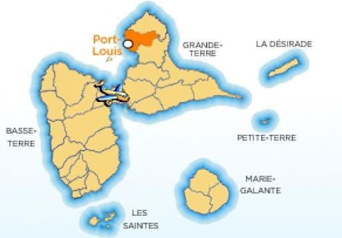
Port Louis
In the north-west of Grande Terre, Port Louis is a peaceful fishing village. Tourists who venture to the north of Grande Terre discover the authentic Guadeloupe, with its warm welcome and simple, generous smiles. Superb unspoilt beaches also await you, perfect for water sports.
Read the full guide
Saint-Claude
Saint-Claude, the ‘volcano town’ situated at the foot of the volcano on the high ground of the island of Basse-Terre, is one of the coolest places on the island. Its vegetation is particularly lush and its gardens magnificent, thanks to the thick clouds that cling to the Soufrière volcano. With a focus on eco-tourism, it is the starting point for numerous hiking trails.
Read the full guide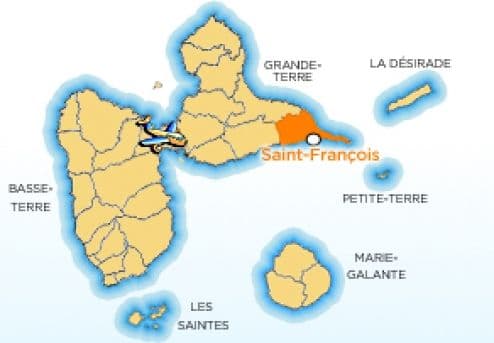
Saint-François
Saint-François boasts modern and varied tourist facilities, including a golf course, an aerodrome, a casino and a marina from which numerous day-trip cruises set sail for the neighbouring islands of La Désirade, Petite Terre and Marie-Galante. The charm of this fishing village is undoubtedly one of Saint-François’s greatest attractions.
Read the full guide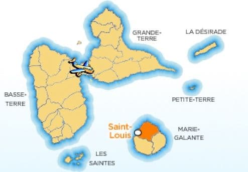
Saint-Louis
Saint-Louis de Marie-Galante is a charming little village where it’s a pleasure to moor your boat. Its small, intimate village centre and its large, welcoming beaches are a perfect match for the warm hospitality of the island’s inhabitants. Saint-Louis offers visiting tourists a change of scenery and a host of attractive activities.
Read the full guide
Sainte-Anne
Prized for its long stretches of white sandy beaches – some wild, others developed – with crystal-clear turquoise waters, Sainte-Anne is a popular ‘waterfront’ town in Guadeloupe. You can travel right through it, following the edge of its stunning turquoise lagoon. Starting from the major hotels or the many beaches, a wide range of water sports and sightseeing activities await you.
Read the full guide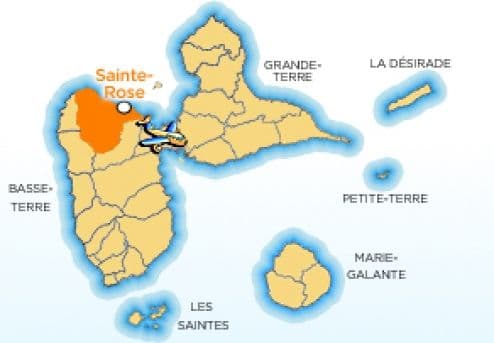
Sainte-Rose
A very welcoming and lively town, Sainte-Rose – situated to the north of the left wing of the ‘butterfly’ – offers visitors some of the most beautiful scenery in Guadeloupe. Set between the sea – the large marine cove dotted with numerous islets – and the mountains, Sainte-Rose boasts an authentic and varied landscape that local tourism professionals will be delighted to help you discover.
Read the full guide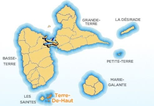
Terre-de-Haut
World-famous and just a stone’s throw from Guadeloupe lies a magnificent archipelago: Les Saintes. The two main islands, Terre-de-Haut and Terre-de-Bas, are surrounded by uninhabited islets. Terre-de-Haut, a popular tourist destination, is a charming village nestled along an extraordinary bay with turquoise waters. A wide range of sporting and cultural activities await you there. In Terre-de-Bas, amongst the fishermen, time stands still.
Read the full guide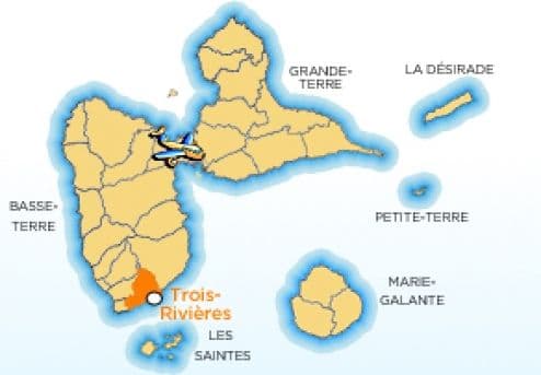
Trois-Rivières
Trois Rivières is a pretty little village, fed – as its name suggests – by three rivers. Situated at the foot of an extinct volcano, La Madeleine, Trois Rivières is the main ferry terminal for Les Saintes. It offers passing travellers an extraordinary view of the bay as they drive along the main road overlooking the sea. Its lush natural surroundings make it ideally suited to eco-tourism.
Read the full guide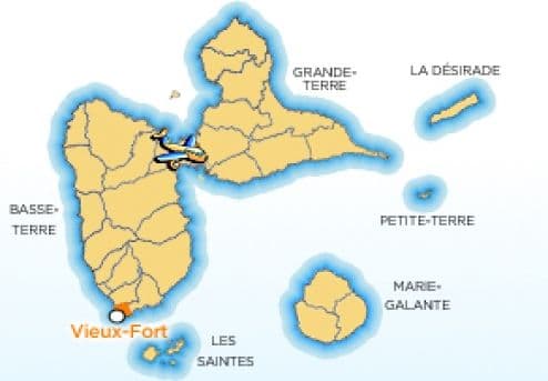
Vieux-Fort
The smallest commune in Guadeloupe, Vieux-Fort, a small fishing village, is situated at the southernmost tip of Basse-Terre and marks the point where the Atlantic Ocean meets the Caribbean Sea, making it a popular spot for windsurfers. Facing Les Saintes, it offers a lovely view.
Read the full guide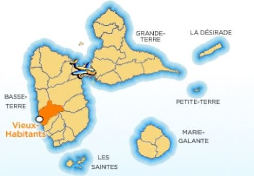
Vieux-Habitants
In the south of Basse-Terre, Vieux-Habitants – founded in the 17th century – is the oldest town in Guadeloupe. Long-standing residents of Guadeloupe have always been drawn to settle there for the quality of life it offers, hence its name. It boasts the island’s most authentic traditional houses and has retained its tradition as a farming region. It boasts numerous attractions, both natural and cultural.
Read the full guide